The hidden nature walks locals love but tourists miss
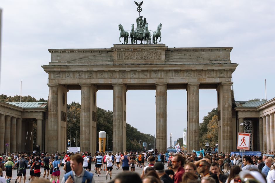
While visitors queue for the Brandenburg Gate selfie, Berliners are slipping into ancient forests, lakeside reed beds and forgotten railway meadows that most guidebooks have never heard of.
While visitors queue for the Brandenburg Gate selfie, Berliners are slipping into ancient forests, lakeside reed beds and forgotten railway meadows that most guidebooks have never heard of.
Berlin has roughly 2,500 kilometres of designated walking and hiking paths within city limits, more green corridor per capita than almost any other European capital, yet the vast majority of recreational trail users on any given summer morning are residents, not visitors. On a July Thursday before 8 a.m., the Barnim Panoramaweg in Pankow is almost entirely dog walkers and cyclists who live within three U-Bahn stops of the trailhead.
That imbalance matters now more than usual. Summer heat records in the Berlin-Brandenburg region have crept upward for the third consecutive year, and the city's public health office, the Gesundheitsamt Berlin, issued guidance in June recommending that residents take physical activity outdoors in shaded, green corridors during morning hours rather than relying on increasingly overheated parks in the city centre. The Tiergarten, beloved, central, well-documented, reached surface temperatures of 38°C during last August's peak. The lesser-known alternatives stay measurably cooler.
Start in Spandau. The Spandauer Forst, a 2,100-hectare woodland wedged between the Havel river and the district's northern residential streets, draws a fraction of the foot traffic of the Grunewald despite being larger and considerably quieter. The forest's eastern edge along Radelandstraße offers a flat, 7-kilometre loop that passes a Bronze Age burial mound, the Hünengräber, which most Berliners in other districts have never seen. Access is free; the nearest S-Bahn stop is Spandau, roughly 14 minutes by regional express from Hauptbahnhof.
Across the city in Treptow-Köpenick, the Müggelberge hills are the closest thing Berlin has to genuine upland terrain. At 178 metres, the Großer Müggelberg is technically the city's highest point, and the forested ridgeline trail connecting it to the Teufelssee, a small, reed-fringed glacial lake, takes about 90 minutes at an easy pace. The Berliner Wanderverein, the city's oldest hiking club founded in 1880, runs guided Saturday morning walks here throughout July and August, departing from S-Bahnhof Köpenick at 9 a.m. Membership costs €36 per year; individual walk participation is free for members.
Then there is the Südgelände Naturpark in Schöneberg, a former freight marshalling yard that has regenerated into a 18-hectare nature reserve since the Deutsche Bahn abandoned the site in 1952. Birch forest has grown up through the signal gantries. The walking route is partly elevated on old rail infrastructure, giving views over the canopy that no conventional park in central Berlin can match. Entry costs €2 for adults. On weekday mornings, the site is genuinely empty.
A 2024 analysis published by the Robert Koch Institut found that Berliners who reported regular physical activity in urban green spaces, defined as parks, forests or waterways within city boundaries, had measurably lower self-reported stress scores than those exercising in built gym environments, with the benefit increasing when the green space was described as "quiet or away from crowds." The study drew on survey data from 4,200 Berlin residents collected between 2022 and 2023.
That research has fed directly into the Senatsverwaltung für Umwelt und Klimaschutz's ongoing Grüne Infrastruktur strategy, a rolling programme to signpost and maintain secondary trail networks that would otherwise remain invisible on standard maps. Phase two of that programme, covering Lichtenberg and Marzahn-Hellersdorf, is scheduled for completion by October 2026 and will add formal waymarking to around 34 kilometres of existing but unmarked paths.
The practical starting point is simpler than a policy document. Download the Berlin Wandern app, published by the Berliner Senat, which maps 57 official city walking routes with offline capability. For the Müggelberge and Spandauer Forst in particular, trails can be narrow and unsigned, comfortable footwear and a downloaded map before you leave home are genuinely worth the five minutes they take. Heat builds quickly by mid-morning in July; start before 8 a.m. if you can. And if you find yourself alone in a birch forest in Schöneberg with nothing but birdsong and old railway iron, that is not an accident. That is what Berliners have known for years.
How does this story make you feel?
Spread the word
About this article
Published by The Daily Berlin
Daily brief
Free, in your inbox before 7am. Weekdays.
More in Wellness


